About Mopik
Adventure motorcycle routes on gravel and forest roads
Less planning. More riding.
Say where from, where to – or “anywhere” – and for how long. Mopik draws a real ride on real roads, shows how much of it is gravel, how long it takes and how much road repeats, and hands you a GPX for your navigator. Across Europe, free and without an account.
01 · The idea
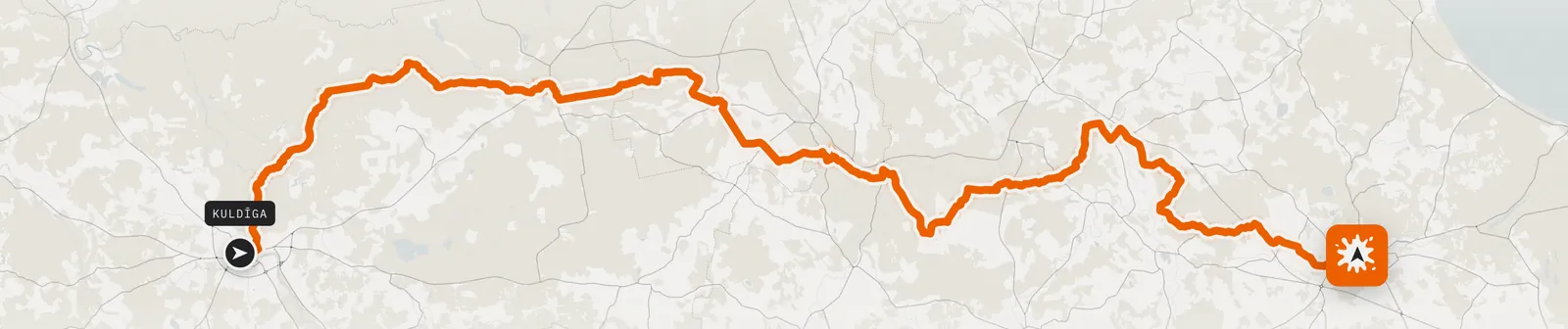
From one sentence to a ride
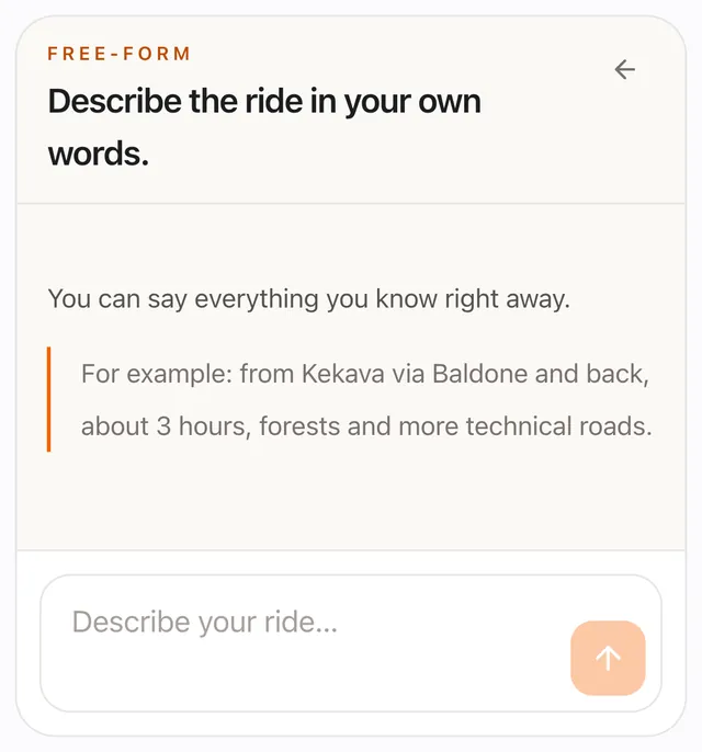
Type a start, stops and, if you like, a finish into the form. Or just describe the ride in the chat in your own words, for example: “from Ķekava via Baldone and back, about 3 hours, forests and more technical roads”.
Mopik understands the places, the time and the kind of riding, tells you what it understood before drawing, and plans the route on real roads.
- Two named versions: “Faster” and “More complex”, each with alternatives of its own.
- After the result, tell the chat what to change.
02 · Profile
Difficulty, style and surface
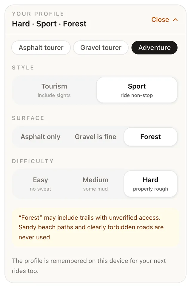
A profile is three questions. Difficulty: Easy – no sweat, Medium – some mud, Hard – properly rough. Style: Tourism (include sights) or Sport (ride non-stop). Surface: Asphalt only, Gravel is fine or Forest.
Or pick a ready one: Asphalt tourer, Gravel tourer or Adventure. The profile is remembered on this device.
- “Forest” prefers forest tracks and trails and keeps away from big roads.
- Mopik never uses motorways.
03 · Trip type
A loop or one way
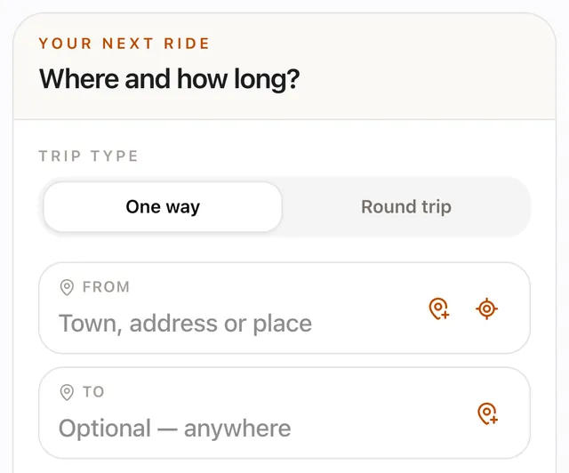
“One way” takes you from A to B with stops along the way. “Round trip” comes back to the start – by other roads, as far as the area allows.
The finish is optional: “Optional – anywhere”, and Mopik picks one. The time can be flexible or limited.
04 · Time
Honest time, by surface
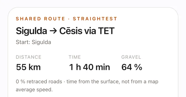
60 km of forest tracks is not 60 km of asphalt. Mopik works out riding time from each stretch's surface and road type, not from a map's average speed.
If you asked for 2 hours and a good ride does not fit, Mopik says so in numbers – “You asked for ~2 h, this version is 2 h 47 min.” – and offers the nearest option. Nothing is swapped quietly.
It is riding time: breaks, fuel stops and weather are not included.
05 · Forest and TET
Real forest tracks and TET
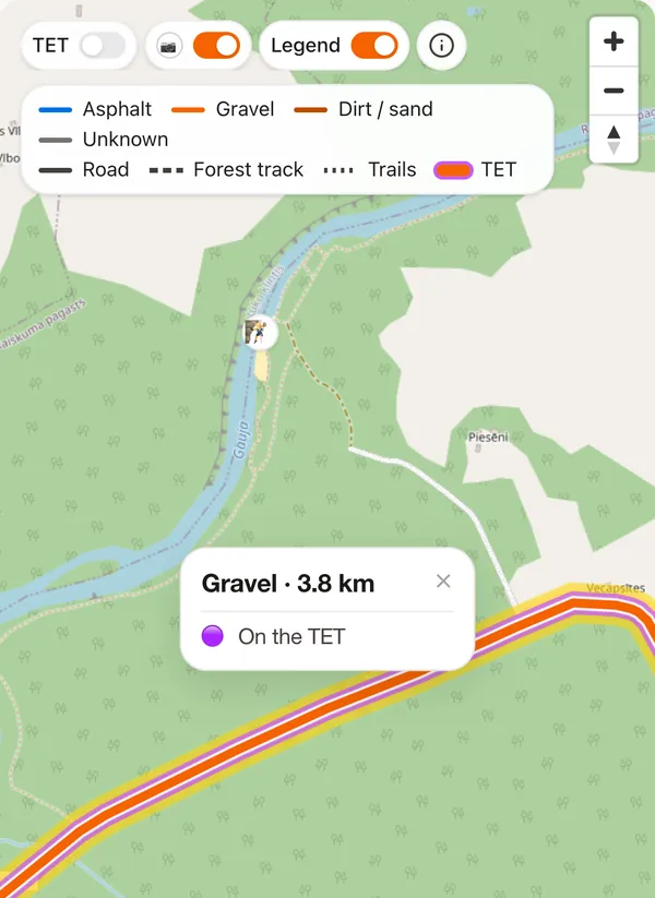
Mopik routes on OpenStreetMap roads with its own motorcycle profile: every road type and surface has its own cost. So “Forest” really takes forest tracks and trails, not just a gravel road past the trees.
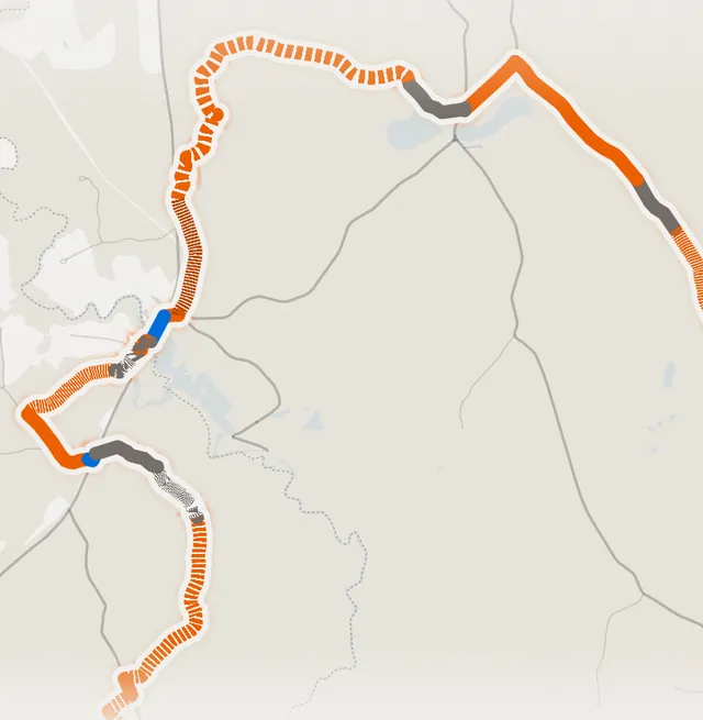
On the map, colour is the surface – asphalt, gravel, dirt and sand, unknown – and the line pattern is the road type: road, forest track, trail. The Trans Euro Trail layer covers 33 countries, and the result shows roughly how many kilometres of the ride follow TET.
Mopik never uses beach and dune paths, or roads OSM clearly forbids.
06 · The one rule
Don't ride the same road twice
A good loop is not measured by a tidy shape but by how much road you would ride twice. Mopik measures it on the line's geometry and shows it on every result: “Retraced: x %”.
The length may drift; the repetition, as far as possible, may not. When no clean loop exists in the area, Mopik says so and offers options with numbers.
07 · Along the way
A sight is not a stop
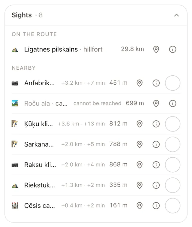
A stop is a place the ride must take you to – you type it. Sights are what Mopik finds along the way: hillforts, viewing towers, manors, fords.
Each shows what it costs – “+km · +min”, out and back or as a loop. Tick it and the detour is in the ride at once, with no new search.
Place data is available for Latvia, Lithuania, Estonia, Poland, Austria, Switzerland, Slovenia and Italy so far.
08 · Gates
Gates on the map, with their OSM facts
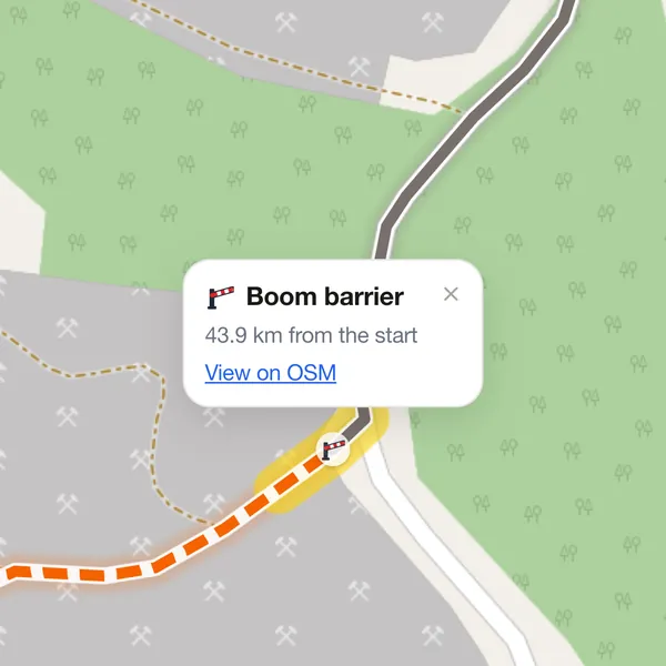
When OpenStreetMap has a gate, a boom barrier or a chain on the road you actually ride, Mopik marks it on the map at exactly that spot.
Tap it and the card says what it is (“Gate”, “Boom barrier”, “Chain”…), what access OSM tags – if any –, how many kilometres from the start it stands, and links to the node on OpenStreetMap.
No guessing: we count only gates on the road itself, never “somewhere nearby”, and the route is not changed because of them. Whether a gate is open or a road is private, Mopik does not check.
09 · Editing
Edit the ride on the map
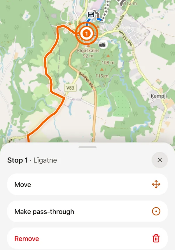
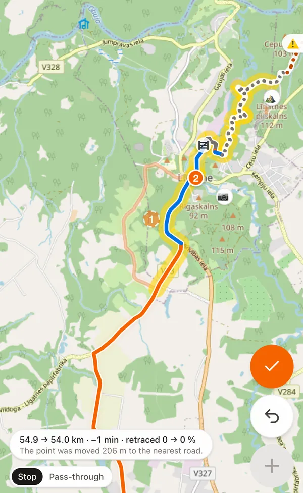
Press “Edit” and change the ride right on the map: move, add or remove a point, or grab the line and drag it where you want to ride.
- Stop or pass-through point. A stop is numbered, has its own row in the list and a point in the GPX. A pass-through point only says which way to go. “Make pass-through” and “Make it a stop” switch both ways.
- A preview before you confirm: the new stretch appears on the map, and a line such as “54.9 → 54.0 km · −1 min · retraced 0 → 0 %” says what the change costs. ✓ confirms, ✕ discards.
- Only the stretch around the change is re-routed. Don't like it – “Undo”.
10 · Share
One link, the whole map
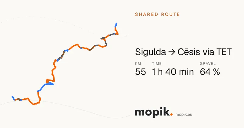
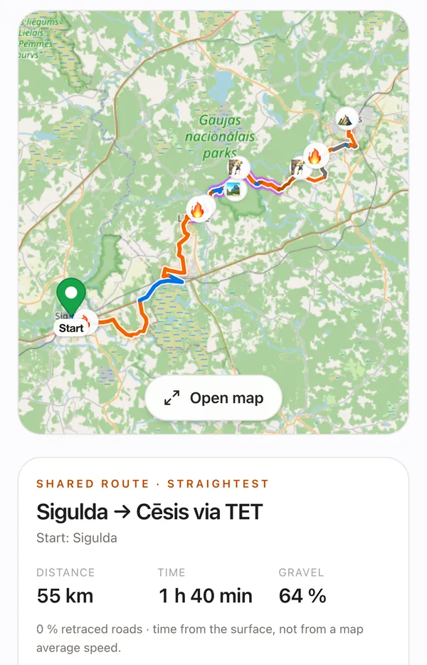
“Share” gives you a link to the ride. Paste it into WhatsApp or Telegram: your friend sees a card with the route and the numbers, and can save it, download the GPX or plan a similar one.
No account. Saved rides stay on this device.
11 · GPX
GPX for Garmin and other navigators
The GPX file carries the whole track exactly as Mopik drew it, and the points: start, finish, numbered stops and the sights you picked.
For Garmin devices it also carries a route: stops are via points and pass-through points are shaping points, so the navigator goes where you put them. Works with OsmAnd, Garmin, DMD2, Locus, Kurviger.
The track is what counts. If a device recalculates the route itself, it may choose other roads.
12 · Languages
Four languages
The whole interface speaks Latvian, Lithuanian, Estonian and English. Mopik picks the language from your country or browser, and you can change it in the header.
The chat replies in Latvian or English for now.
13 · Europe
From Rīga to the Alps
Mopik routes across Europe on its own BRouter server. The profile is calibrated on Latvian roads; outside the Baltics the route and the numbers are real, but place names and gates exist only in the countries whose data is already prepared.
Very long rides (around 1000 km) do not generate yet. Mopik tells you straight away, not after a minute of waiting.
- routing
- Europe
- countries in the TET layer
- 33
- countries with places and gates
- 8
Honestly
What Mopik does not check
Private roads
Mopik never uses roads OSM clearly forbids, and marks “Unverified access” where motorcycle access is not confirmed in the data. Whether a road is private or a gate is open, Mopik does not know.
Road condition
Mud, fallen trees, flooded stretches and roadworks are not in the map data.
How complete the map is
If a road or its surface is not in OpenStreetMap, Mopik does not know it. Unknown surface is grey on the map.
Turn-by-turn navigation
Mopik plans the ride and gives you a GPX; ride it with your own navigator.
Always follow the road signs.
Questions
Frequently asked
Is Mopik free?
Yes. Mopik is free to use and needs no account.
Where does Mopik work?
Routing works across Europe. The TET layer covers 33 countries. Sights and gates are available for Latvia, Lithuania, Estonia, Poland, Austria, Switzerland, Slovenia and Italy so far.
Does the GPX work with Garmin?
Yes. The GPX has the track, the points and a Garmin route in which stops are via points and pass-through points are shaping points. It also works with OsmAnd, DMD2, Locus and Kurviger.
Does Mopik know which roads are private?
No. Mopik never uses roads OSM clearly forbids, and it marks gates on the road itself and unverified access, but it does not check private roads. Always follow the road signs.
How long a ride can Mopik plan?
Day rides, comfortably. Very long rides (around 1000 km) do not generate yet – Mopik says so before the search.